|
|
|
|
| Google Translation | ||
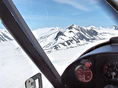
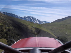
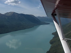
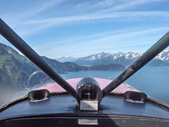
After several days of intensive training, I had earned my seaplane rating. But, aside from the training areas, I had seen very little of Alaska. On my last day in Moose Pass, Charles and I got in the Super Cub, and took a sightseeing flight over the Kenai Peninsula.
As I was now a certified seaplane pilot, Charles indicated that he would be my passenger. I flew the plane, and he pointed the way.
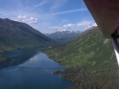
For the next two hours, we saw some fantastic scenery!
(Click any image to see a larger version.)
 |
 |
 |
 |
 |
Our Route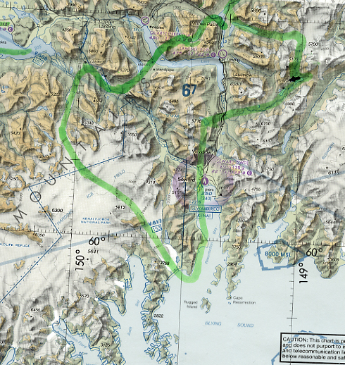 After our flight, Charles took a highlighter marker and traced our route on a Seward sectional chart. We started in Moose Pass (near the top of the map) and proceeded counter-clockwise. |
 |
|
 |
 |
||
|
| ||
|
|
|
|
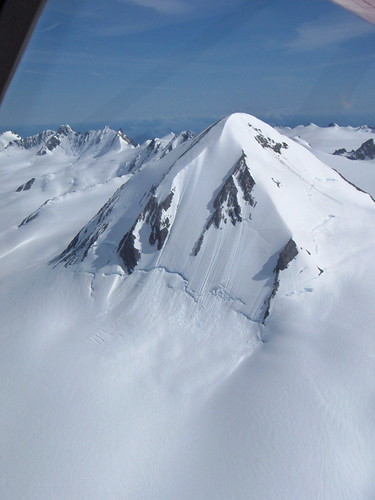
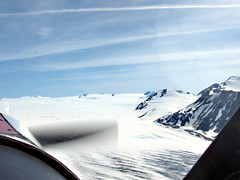
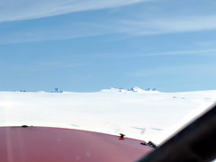
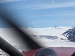
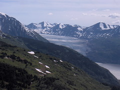
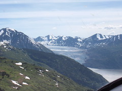
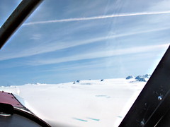
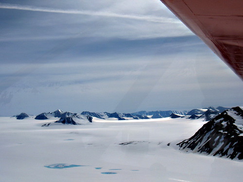
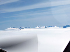
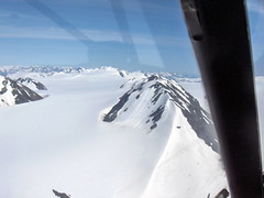
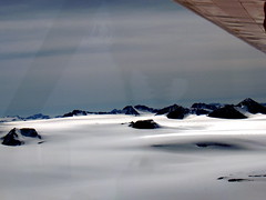
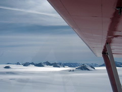
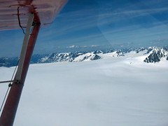
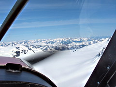
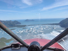
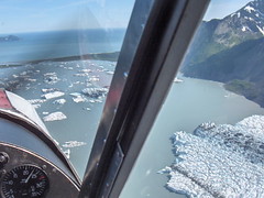
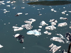
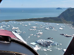
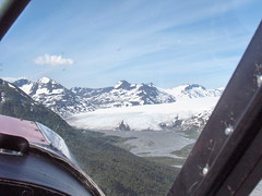
Ice Fields and GlaciersIce fields and glaciers are made of snow that has been compressed into ice over the millenia. Each year more snow falls onto the ice fields. The overflow areas from ice fields are glaciers. (More) |
The Harding Ice Field is the light-colored, empty-looking area in the lower-left of the map shown above. Charles compared it to the arctic scenes from Star Wars. Most of this area has never been touched by man.
If you take an area covered with mile-high mountains, then fill-in all the valleys with ice and snow until only the tallest peaks are visible, you've got an ice field. (The Harding Ice Field is bigger than the state of Rhode Island.)
 |
 |
 |
|
 |
 |
||
 |
 |
 |
 |
 |
 |
 | |
 |
 |
||
 |
 |
 |
 |
Global Warming | |||
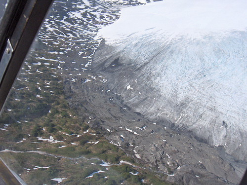 |
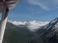
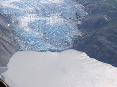
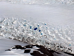
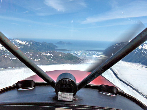
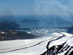
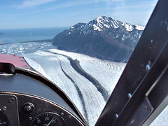
Charles, my flight instructor, has been flying the Alaskan bush for many, many years. We flew over this glacier so he could show me how far the glacier has receded. He said that under normal conditions, the tree line traces the edge of the glacier. It is common to see large trees grow right up to the beginning of the glacier. In ths photo (and this one) you can see a gap between the trees (left side) and the glacier (right side). This gap, currently about forty feet wide, is evidence of receding glaciers due to global warming. | ||
SewardSeward is the closest city to Moose Pass. About 30 miles to the south, it is popular destination for cruise ships. | |||
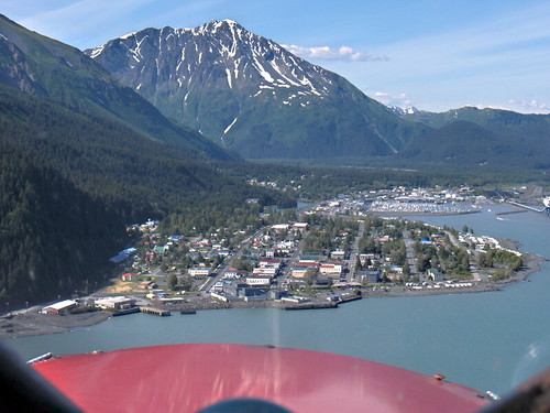
Approaching Seward |
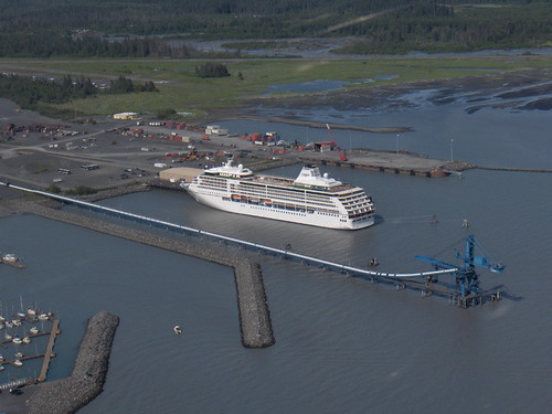
Cruise Ship in Seward Harbor | ||
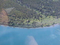
Rental CabinsThe Forestry Service has a number of cabins that you can rent for about $20 a night. This one, located at Upper Paradise Lake, includes a wood-burning stove, boat, outhouse, and plenty of firewood. Flying over the cabin, you notice that there are no roads or hiking trails anywhere for miles. The only access is by float plane. This cabin, according to Charles, is very popular with with hunters and fishermen, as well as with couples craving a secluded, romantic week-end. Unfortunately, we were not wearing our hip waders, so we could not go ashore for a tour. | 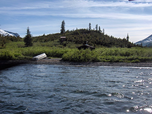
Forestry Service rental cabin at Upper Paradise Lake
| ||
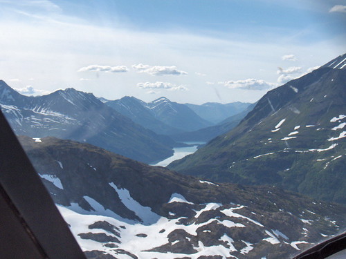
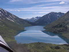
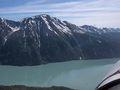
Heading Back to Trail Lake
Grant Lake is in the center of the shot | After nearly two hours over the Kenai Peninsula, Charles and I headed back home to Trail Lake. Charlie landing at Trail Lake
|
||